Difference between revisions of "The National Map"
(Created page with "'''To go directly to the NED download page, go here: http://seamless.usgs.gov/website/seamless/viewer.htm''' The National Elevation Dataset (NED) is a new raster product assemb...") |
Revision as of 12:02, 25 September 2012
To go directly to the NED download page, go here: http://seamless.usgs.gov/website/seamless/viewer.htm
The National Elevation Dataset (NED) is a new raster product assembled by the U.S. Geological Survey. NED is designed to provide National elevation data in a seamless form with a consistent datum, elevation unit, and projection. Data corrections were made in the NED assembly process to minimize artifacts, perform edge matching, and fill sliver areas of missing data. NED has a resolution of one arc-second (approximately 30 meters) for the conterminous United States, Hawaii, and Puerto Rico and a resolution of two arc-seconds for Alaska. More info can be found at http://gisdata.usgs.net/NED/.
SRTM 30m and SRTM 90m data is also available from the the USGS Seamless Distribution site. Information on the SRTM data can be found at http://srtm.usgs.gov/ .
How to download
The data can be downloaded at http://viewer.nationalmap.gov/viewer/.
There is online help available by clicking on the Tutorial link in the header of the page.
- Select the Download tab on the right hand side of the display.
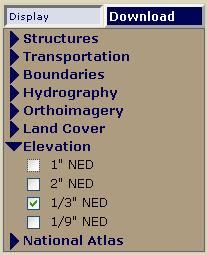
- Check the boxes for NED, 1/3 NED or 1/9 NED.
- Using the Zoom tool, you can zoom into the area you are interested in.
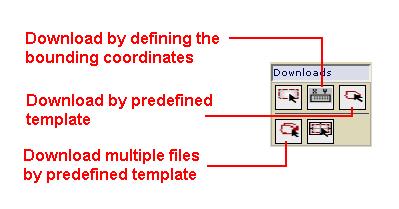
- Define the area by either clicking the Define Download Area by Coordinates tool under Download tool group.
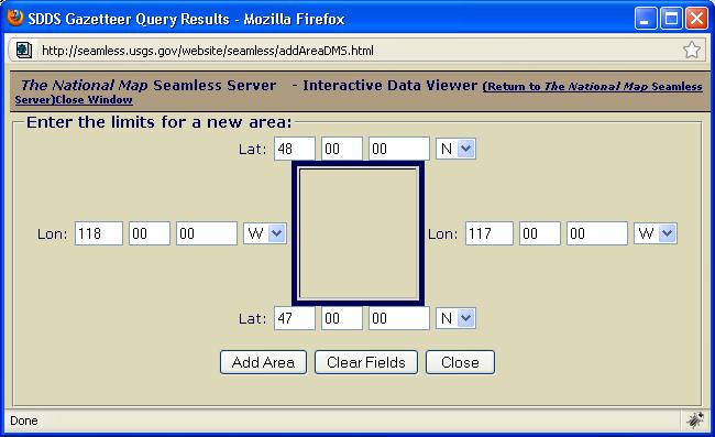
- If using the Define Download Area by Coordinates, a dialog will appear that is used to define an area for download. (The example shown is for a 1X1 degree block)
- Once the area is defined you will be taken to the download page. You will need to click "Modify Data Request" and change the format to the BIL_16INT format. Click Save Changes & Return to Summary.
- Click Download. You will be prompted to save the file once it is ready for download
How to use the seamless NED data with the Pathloss program.
Decompress the dataset to its own directory. The dataset is comprised of 16 files…
*.aux          *.hdr       METADATA.dbf  Metadata.xml
*.bil          *.prj       METADATA.prj  NED DataDictionary.pdf
*.bil.aux.xml  *.stx       METADATA.shp  NED_Release_Notes_June10.pdf
*.blw          meta1.html  METADATA.shx  output_parameters.txt
In Version 4.0 make sure to use NED CONUS for data in Alaska. Do not use NED Alaska.
The NED (CONUS) data uses the NAD83. NAD27 Coordinates are transformed automatically.
The SRTM data uses the WGS84. NAD83 and NAD27 Coordinates are transformed automatically.
- In the Pathloss program click Configure – Terrain Database and depending on the dataset select either NED CONUSor NED Alaska from the drop down list.
- Click Setup Primary (or Setup Secondary depending on your selection).
- Click the file button and browse to find and load the file with the BIL extension. The program is now setup to use the selected BIL file.


