Difference between revisions of "MRLC"
From PathlossWiki
(→Multi Resolution Land Characteristics Consortium) |
(→Multi Resolution Land Characteristics Consortium) |
||
| (4 intermediate revisions by 2 users not shown) | |||
| Line 1: | Line 1: | ||
== Multi Resolution Land Characteristics Consortium == | == Multi Resolution Land Characteristics Consortium == | ||
| + | |||
| + | === The MRLC site has discontinued the BIL format. please use the [[FetchSRTM]] tool to download NLCD data in the BIL format === | ||
A seamless download site that has NED and NLCD data for the US in BIL format. | A seamless download site that has NED and NLCD data for the US in BIL format. | ||
| Line 9: | Line 11: | ||
Follow these steps to download the terrain data in the BIL format | Follow these steps to download the terrain data in the BIL format | ||
| − | + | ||
| − | [[File:Mrlc-1.jpg]] | + | [[File:Mrlc-1.jpg|700px]] |
| − | + | ||
| − | [[File:Mrlc-2.jpg]] | + | |
| − | + | ||
| − | [[File:Mrlc-3.jpg]] | + | [[File:Mrlc-2.jpg|700px]] |
| + | |||
| + | |||
| + | |||
| + | [[File:Mrlc-3.jpg|700px]] | ||
| + | |||
| + | |||
Click the download button for each data-set and wait for the extraction process to complete (Could take 5-10 minutes or longer) | Click the download button for each data-set and wait for the extraction process to complete (Could take 5-10 minutes or longer) | ||
| Line 24: | Line 32: | ||
Select Configure -> Setup GIS Configuration from the Pathloss 5 main menu. | Select Configure -> Setup GIS Configuration from the Pathloss 5 main menu. | ||
| − | [[File:Mrlc-4.jpg]] | + | [[File:Mrlc-4.jpg|600px]] |
Select the top level folder that contains all the unziped NED data. | Select the top level folder that contains all the unziped NED data. | ||
| Line 30: | Line 38: | ||
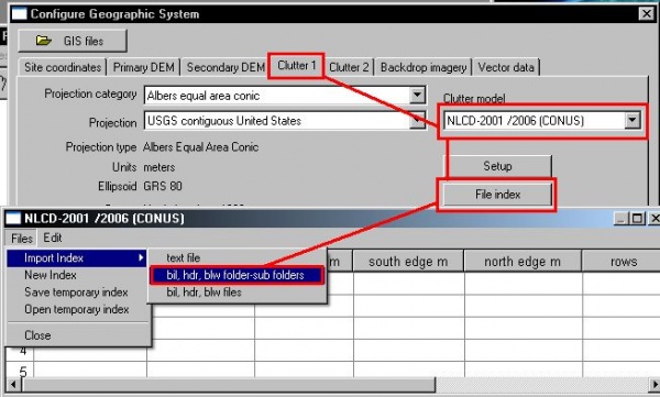
Clutter is set up similarly. | Clutter is set up similarly. | ||
| − | [[File:Mrlc-5.jpg]] | + | [[File:Mrlc-5.jpg|600px]] |
Latest revision as of 15:27, 9 January 2019
Contents |
Multi Resolution Land Characteristics Consortium
The MRLC site has discontinued the BIL format. please use the FetchSRTM tool to download NLCD data in the BIL format
A seamless download site that has NED and NLCD data for the US in BIL format.
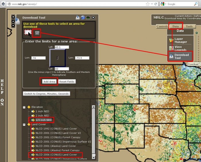
Download the data in BIL format
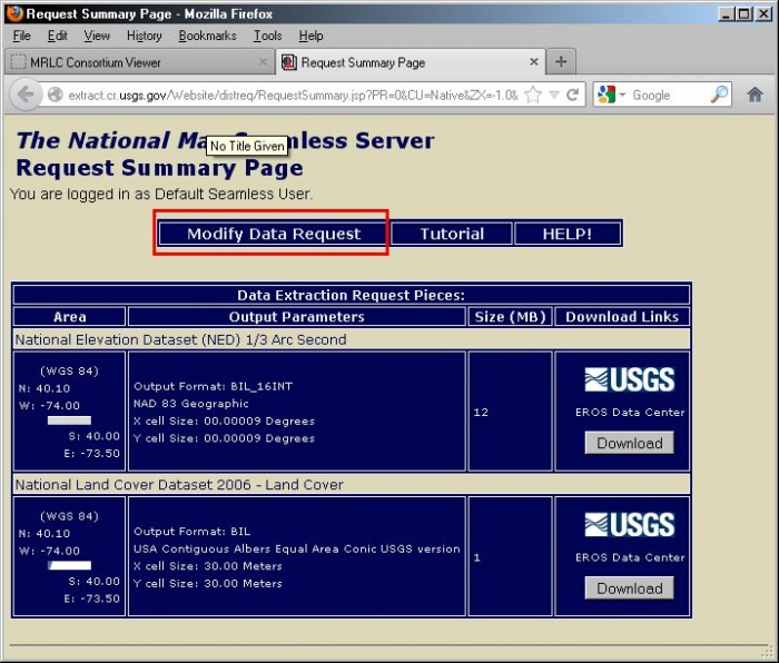
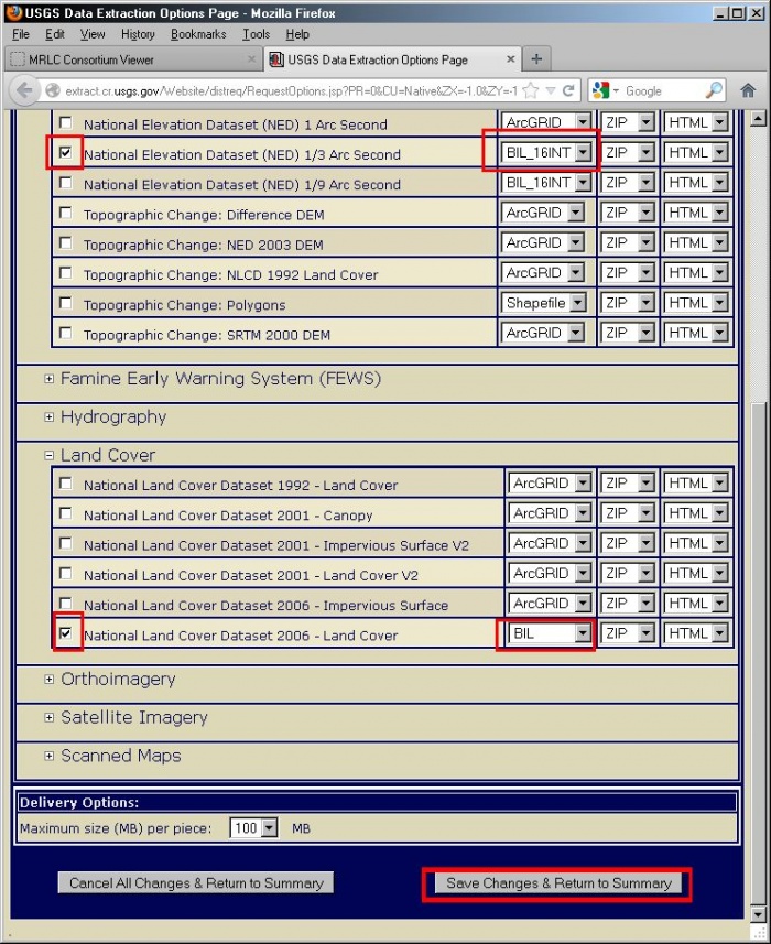
Follow these steps to download the terrain data in the BIL format
Click the download button for each data-set and wait for the extraction process to complete (Could take 5-10 minutes or longer)
Unzip the files in to a folder. Use separate folders for NED and NLCD data
Configuring Pathloss 5 to use the data
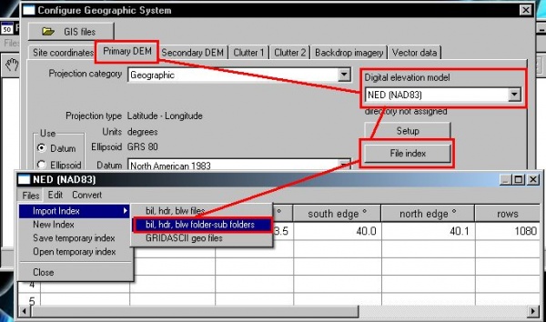
Select Configure -> Setup GIS Configuration from the Pathloss 5 main menu.
Select the top level folder that contains all the unziped NED data.
Clutter is set up similarly.
